by Sherri on October 23, 2007
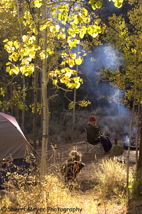
Our camp at Buckeye Campground.
We made base camp at beautiful Buckeye Campground, located along Buckeye Creek in the Toiyabe National Forest. That put us in close proximity to the things we wanted to do and places we wanted to explore.
This turned out to be another one of our favorite camping spots. The camp sites were huge and only a couple of them were occupied when we were there. The fall color was intense, as you can see in this photo. And there were several great hiking trails nearby to choose from. NOTE: There is a fee to camp at Buckeye. There are also free campsites nearby.
by Sherri on October 22, 2007
 Â
Â
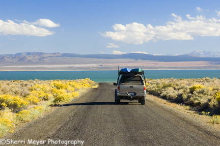
Photo – View of Mono Lake from the Cottonwood Canyon Road
The road we were traveling on turned into the Cottonwood Canyon Road, which eventually led us to Mono Lake.Â
We drove around to the tourist side of the lake, with plans of doing a sunset paddle in our kayaks. We had wanted to do this for a long time. Unfortunately, our timing was off. The winds are fierce in the afternoon. We could hardly get out of the car, let alone do a paddle!
We did a lot of planning and researching for this trip, but we failed to find out when the best times to paddle Mono Lake are. Next time we visit that area, we will paddle at sunrise.
by Sherri on October 21, 2007
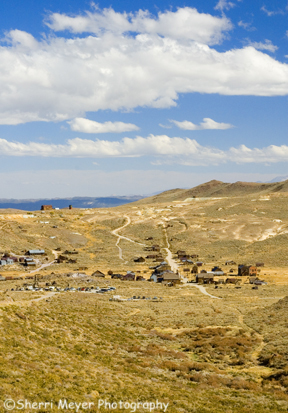
Photo – Bodie State Historical Park, as seen from the Bodie Ghost Town TrailÂ
From the Masonic Trail, we intersected Aurora Canyon Road (also known as the Bodie Ghost Town Trail) and dropped down into Bodie. Â
Bodie, California is located in the eastern slopes of the Sierra, close to the Nevada border and is known as the best preserved ghost town in California. It was once a gold-mining town with 10000 residents way back in 1879.
We will be adding this photo of Bodie, as well as photos taken in the park from our previous trip, to our stock photo galleries soon.
by Sherri on October 20, 2007

Photo – Mural of Western States 100-Mile Endurance Race Participants Â
The first annual Endurance Expo is happening today in Auburn, CA. You can read all about it here.
by Sherri on October 20, 2007
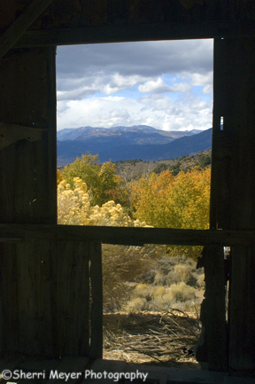
Photo – “Window on the West”
This was shot from inside of the Chemung Mine. See the previous post.Â
by Sherri on October 20, 2007
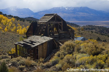
Photo – Chemung Mine along the Masonic Trail, with the Sierra Mountains in the background
This is one of several old mines along the back road to Bodie. There will be more photos from this fall colors trip to come soon!
by Sherri on October 19, 2007
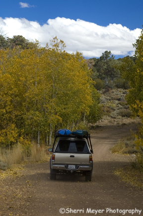
Photo – The Masonic Trail
This is another shot taken on our fall color road trip last October.Â
I used to go to Bodie a lot as a kid. In fact, my biggest memory from those trips, was driving the 17-mile dirt road in our V Dub Bug. That wasn’t necessarily fun back then! But, now, as an adult, I prefer the dirt roads and so does my husband, Jeff.Â
Jeff and I had been to Bodie a couple years prior to this trip, so we weren’t planning to stop there this time around. But, on that trip we entered from the main route, which has been paved since I was a kid, unfortunately!
What we did want to do, however, was to drive the 14-mile back road into Bodie, The Masonic Trail, which happens to also be a dirt road. It starts from highway 395 and ends up in Bodie. It was well worth it!
Isn’t it funny? The roads that used to drive me crazy as a kid are now what I like best!
 Â
by Sherri on October 17, 2007
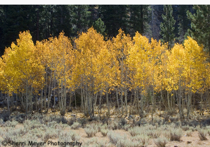
Photo – Aspen grove revised (cut both the saturation and the underexposure by 1/2)
For those of you that have been adding your comments regarding this Aspen grove shot, I’ve added the 3rd shot that I hope will be the pick of the pics.
What do you think?
by Sherri on October 17, 2007
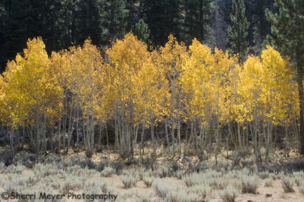
Photo # 1 – As shot (Aspen grove near Bridgeport, CA)
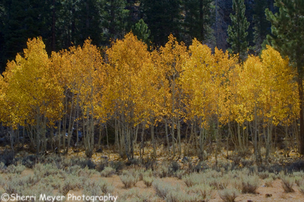
Photo # 2 was underexposed, then saturated (Aspen grove near Bridgport, CA)
It looks like we are not going to get in a fall color shoot this year in the high country. We were in Sierra County, near Truckee about 3 weeks ago and we were too early. Now, it’s too late. So I decided to put up a photo from our fall colors trip last October, along scenic highway 395. Actually, I’m putting up 2 of them again and I would love your opinion on which one you prefer. I will go ahead and give you my opinion. I prefer #2. But, I loved #1 until I started experimenting with it.
I’m learning that just about any photo can be improved, even when you think it can’t. But, then again, that’s just my opinion!
by Sherri on October 16, 2007
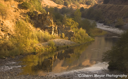
Photo – Fall colors along the middle fork of the American River, Auburn, CA
We don’t get the fall colors here in the Sierra Foothills like other parts of the country do. But, it’s still beautiful just the same. It’s just a different kind of beautiful!Â
Â