by Sherri on August 12, 2008

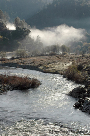
Indian Creek, Taylorsville, California
Our first 3 nights were spent in Taylorsville, a little “Po Dunk” town in Plumas County, southeast of Lake Almanor.
We camped on 10 acres of private property with our friends, along beautiful Indian Creek. The photo above was taken right next to our campsite.
While we were there, we did a day trip to Lasen National Park. Now, we have moved on to McArthur-Burney Falls Memorial State Park.
We hope to write again in a few days, but we have found out that Blogging while on the road is harder than we thought.
Adios,
Jeff & Sherri (Cocoa too!)
by Sherri on July 18, 2008
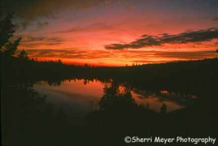
Sunset over Blue Lake, Tahoe National Forest, California
Here is another shot of Blue Lake taken from the ridge, overlooking the lake. This version is the way it actually looked when I shot it.
 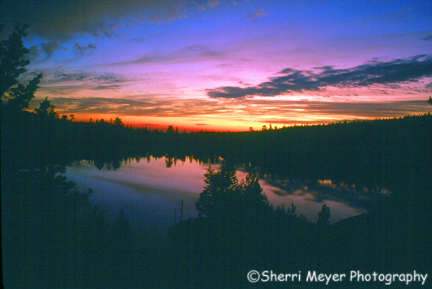
For this version of the photo above, I did a little adjusting in PhotoShop to bring out the blue tones. After all, the name of the lake is “Blue Lake!”
by Sherri on February 25, 2008
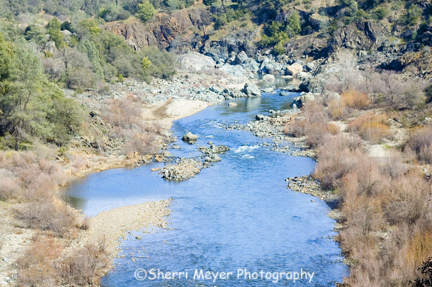
Middle Fork of the American River, Auburn State Recreation Area, Auburn, California
The American River is not literally my backyard, but it’s only minutes away. Within 15-20 minutes, I can be in a number of photographic hot spots this good, or better!
This shot was taken during our hike on the Quarry Road Trail.
by Sherri on February 18, 2008
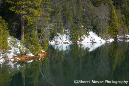
Snowy shoreline and reflections at Sugar Pine Reservoir, Foresthill, CA
For this shot of Sugar Pine Reservoir, I eliminated the sky. One way to add impact to your photographs is by eliminating the sky, especially when it’s not all that interesting.
For more on this, read my post When in doubt – leave it out!
by Sherri on January 29, 2008
Foggy morning over the confluence of the north and middle forks of the American River, Auburn, CA
You can now order prints of the photo above at a 50% discount, in 3 different sizes and finishes. To order this print at this special price, please visit our Print Specials gallery.
by Sherri on January 23, 2008
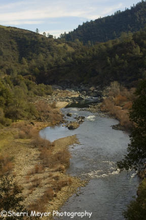
Middle Fork of the American River, Auburn, CA
This photo was taken on the same day the waterfall photo was taken. We were hiking on the right side of the river on the Western States Trail in El Dorado County. Had we been hiking on the other side of the river, we would have been hiking in Placer County.Â
[click to continue…]
by Sherri on October 25, 2007
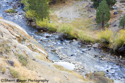
Photo – View of the soaking pools on Buckeye Creek
Here is another shot of Buckeye Hot Spring. This photo shows what the soaking pools actually look like. Posting this makes me want to jump in the car and go there right now!
This wraps up my photo essay on our fall colors trip last October.
by Sherri on October 24, 2007
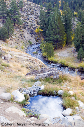
Buckeye Hot Spring, near Bridgeport, California.
This is one of our favorite hot springs in California and a soak here is free! It is located on the creek, clothing is optional and you can often have it all to yourself. Plus, it is a short drive or walk from Buckeye Campground.
The small pool in the foreground is a hot water source. This pool is scalding hot and is not for soaking in. The water flows down the hill from this pool and eventually drops into Buckeye Creek. There it mixes with the creek water and cools down to temperatures suitable for soaking.
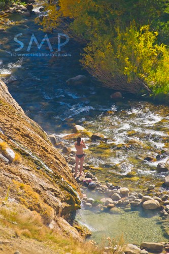
Woman enjoying Buckeye Hot Spring, Eastern Sierra, California. Put this on your “Bucket List!”
If you are going, make sure you take everything you will need with you (towel, snacks, water etc.) and wear good footwear. The walk down to the creek is very steep and slippery in spots and you won’t want to make the trek too many times. If soaking at night, be sure to pack a flashlight also.
Every time we travel scenic highway 395, we make it a priority to visit Buckeye Hot Spring!
Directions – To get to Buckeye from the northern end of Bridgeport, turn off of Route 395, turn west on Twin Lakes Road and travel seven miles. Turn right just past Doc and Al’s Resort, then cross the bridge going over the creek. Continue uphill along a gravel road, past Buckeye Campground. At the top of the hill you’ll find a parking area. The springs are down the trail from the parking lot. Closed in the winter.
by Sherri on October 20, 2007
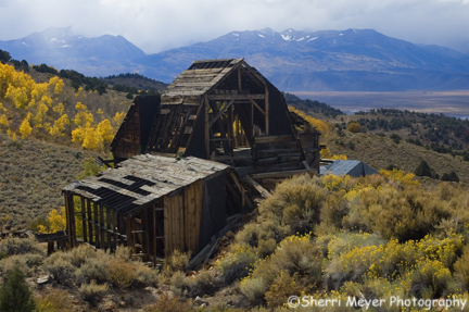
Photo – Chemung Mine along the Masonic Trail, with the Sierra Mountains in the background
This is one of several old mines along the back road to Bodie. There will be more photos from this fall colors trip to come soon!

